|
Historic Sites of the U.S.-Mexican War
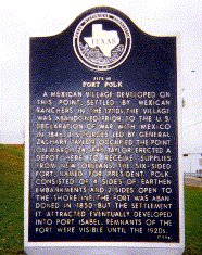
Fort Polk Site, Port Isabel, Texas
|
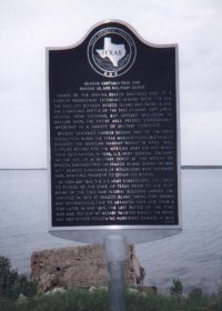
On March 25, 1846 an advance party of the "Army of Occupation" reached Point Isabel (now Port Isabel), where General Taylor established a fortified supply depot he named Fort Polk in honor of the President. A small garrison, commanded by Major John Munroe, was left at Point Isabel while the bulk of Taylor's troops continued to advance to the Rio Grande. Throughout the Mexican War Fort Polk served the U.S. army as a supply depot and hospital. Many soldiers, who died of illness or wounds, were buried in unmarked graves outside the walls of Fort Polk. Shortly after the war the site was abandoned. In 1995, the Cameron County and Texas State historical commissions erected the marker shown here.
It stands on the grounds of the famous Port Isabel Lighthouse, built atop a mound of earth which constitutes the only remaining physical evidence of Fort Polk. Both lighthouse and marker are located beside County Hwy. 100, about a block from the western end of the causeway which links the town of Port Isabel with South Padre Island.
|
[Return to Top]
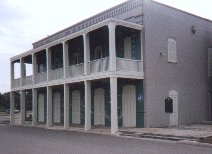
Port Isabel Historical Museum, Port Isabel, Texas
|
In May 1997 the Port Isabel Historical Museum, located a block south of the lighthouse, was formally opened. It is housed in the old Charles Champion Building, which was once a post office and a general store. The museum's ground floor exhibits tell the story of Port Isabel and vicinity from prehistoric times to the present. An exhibit on the top floor is devoted soley to the U.S. - Mexican War and includes artifacts found at historic sites locally.
|
The museum is located at 302 Queen Isabella Blvd. on property that is close by the site of Taylor's supply depot. In 1999, the museum hosted the annual meeting of the Descendants of Mexican War Veterans.
[Return to Top]
Rancho de Carricitos, Thornton Affair Site
|
|
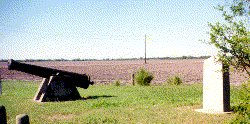
This granite marker, erected by the State of Texas in 1936, stands alongside a cannon barrel (not Mexican War vintage) on the north side of U.S. Hwy. 281, about 20 miles northwest of Brownsville. It commemorates the "Thornton Affair" - the incident which sparked the Mexican War.
|
On April 25, 1846, at an abandoned hacienda somewhere near this site, Captain Seth Thornton and less than 70 U.S. dragoons were ambushed by some 2,000 Mexican troops commanded by General Anastasio Torrejon. During the skirmish, 16 American soldiers were killed. The remainder, including Thornton, were captured and taken to Matamoros. After President Polk received news of the incident, he addressed a joint session of Congress, announcing: "American blood has been shed on American soil." On May 13, 1846 Congress declared war on Mexico. The marker erroneously refers to the leader of the dragoons as Captain "Phillip" Thornton.
Read Captain Hardee's official report of the skirmish.
[Return to Top]
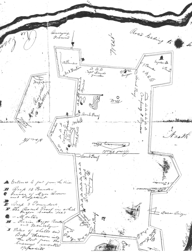
Original Fort Brown (a.k.a. Fort Texas), Brownsville, Texas
|
|
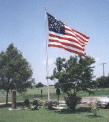
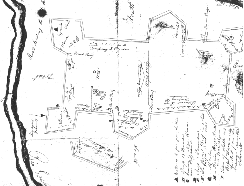
On March 27, 1846 troops under command of General Zachary Taylor reached the north bank of the Rio Grande, following a more than 2-week long march from Corpus Christi. During April, Taylor's men labored to construct an earthen, star-shaped fort designed by Capt. Joseph K. F. Mansfield of the Corps of Engineers. "Fort Texas," had walls 9' feet high and a moat 8' feet deep, with a parapet 15 feet wide.
On May 1, 1846, General Taylor took the bulk of his troops to Point Isabel, fearing his supply depot there was in danger of attack.
|
Two days later, Mexican forces in Matamoros commenced a seven-day long artillery bombardment and siege of Fort Texas. Miraculously, only two Americans were killed: Sgt. Horace Weigart and Major Jacob Brown, the fort's commander. The fort was afterward named in Brown's honor. The city of Brownsville, founded in 1848, is also named for Major Brown. The original earthen Fort Brown was an active military post until after the Civil War when a new Fort Brown, consisting of a cluster of stone buildings, was constructed nearby. 150 years of erosion, along with 20th century levee construction, has considerably reduced the visible remains of the original fort, which lie adjacent to the Fort Brown Municipal Golf Course. The flagpole seen here was erected in 1996 as a gift from The Descendants of Mexican War Veterans to the City of Brownsville. It stands beside existing historic markers, one of which was also a gift from the DMWV.
You may view maps of Fort Brown, as it appeared at the time of the war:
You may also read an official report of the siege of May 1846.
[Return to Top]
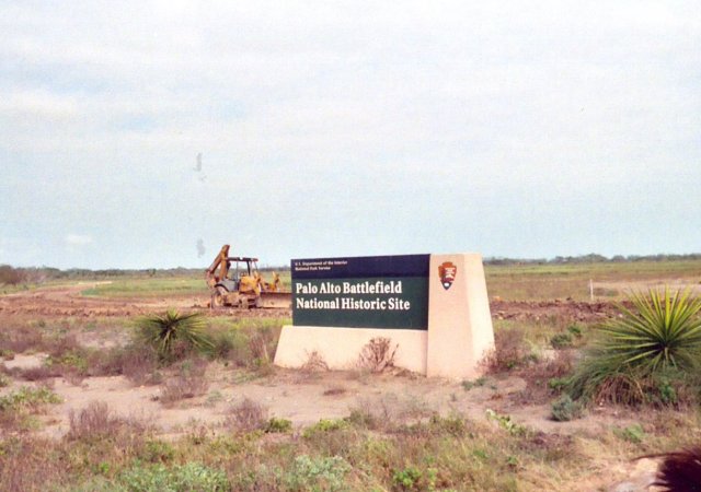
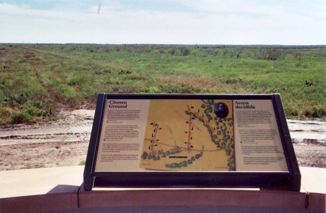
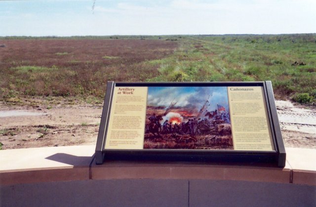
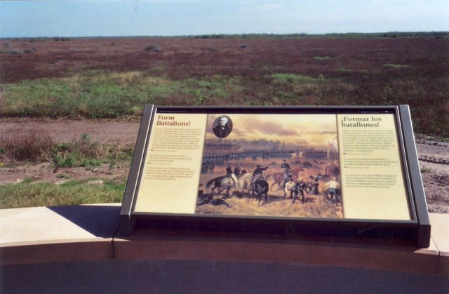
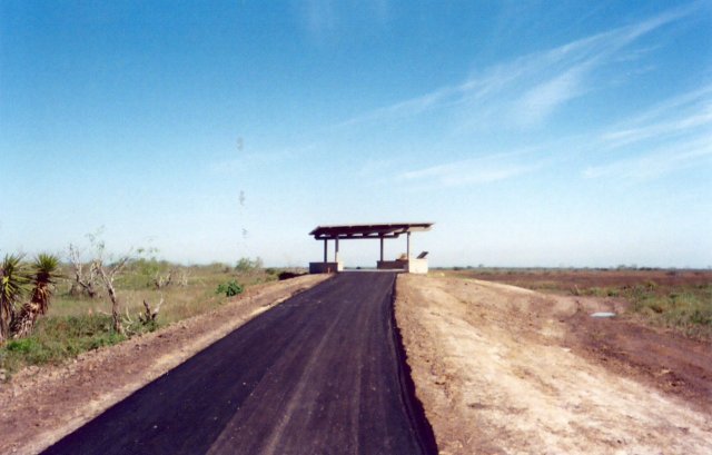
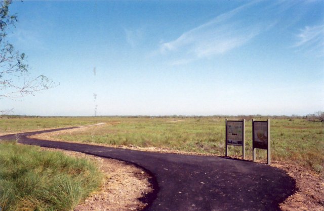
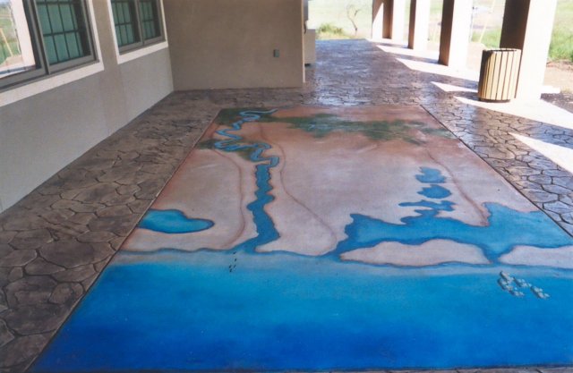
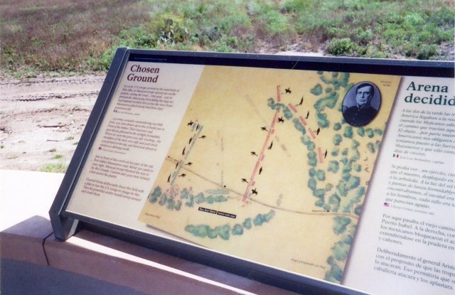
Palo Alto Battlefield National Historic Site, Brownsville, Texas
|
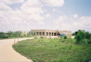
Photo by Bill Bozic. Used with permission.
|
On May 8, 1846, at this site, Mexican forces under the command of General Mariano Arista fought Zachary Taylor's "Army of Occupation". The battle was primarily an artillery duel which the Americans claimed as a victory. Presently, only a portion of the land near the battlefield is owned by the federal government but negotiations are underway to secure more of the property. The new Palo Alto Visitors Center opened in January 2004. Be sure to also visit the NPS Palo Alto website.
Read General Taylor's official report of the battle.
|
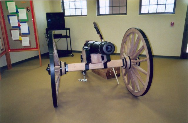
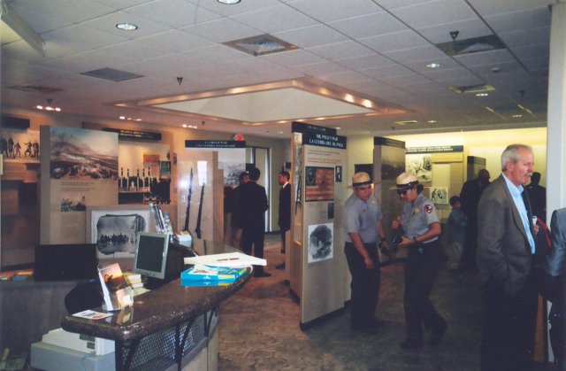
Below are some "thumbnail" views of Palo Alto Battlefield Park. To see larger images, click on the "thumbnails."
Photos courtesy Bill Bozic. Used with permission.
[Return to Top]
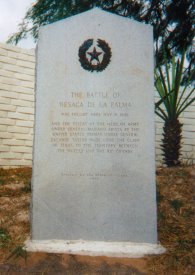
Resaca de la Palma Battlefield, Brownsville, Texas
|
|
Following the Battle of Palo Alto, Arista withdrew his troops to a wooded area alongside a half-dry resaca, about 2 miles north of the Rio Grande. He knew that Taylor, marching south along the Camino de Matamoros, would have to cross the resaca at that point. The granite marker seen here, commemorating the Battle of Resaca de la Palma, was erected by the State of Texas in 1936. It is located on the east side of Paredes Line Road (FM 1847) near the spot where the road crosses Resaca de la Palma - at the same place where Arista's artillery opened up on the approaching Americans on May 9, 1846. The battlefield overlaps the road on both the east and west. On the west side, modern development has encroached on the site, spoiling its integrity. The larger eastern portion, formerly in private hands, is now owned by the City of Brownsville, which hopes to maintain the site as a historical park.
|
Read General Taylor's official report of the battle.
[Return to Top]
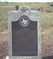
Camp Belknap Site
|
|
As part of the U.S. declaration of war on May 13, 1846, Congress authorized the raising of up to 50,000 volunteers from the various states. Camp Belknap, established in July 1846, was named for William Goldsmith Belknap, a regular army officer. Located on a long, narrow rise of land called the "Loma de la Estrella" (Spanish for "Hill of the Star"), it was one of the largest volunteer troop encampment sites of the Mexican War. This Texas Historical Commission marker, erected in 1996, stands near the site - on Boca Chica Road, (State Hwy. 14), about 15 miles east of Brownsville. A joint effort of the DMWV and the Cameron County Historical Commission, it was formally dedicated in May 1997.
|
|
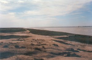
The northern tip of Brazos Island is still a remote site. It is accessible by driving east from Brownsville on Boca Chica Road (State Hwy. 14), then north about eight miles on the hard-packed sand beach. There is little to see but the site is popular with fishermen and families who like to camp out on the beach where U.S. soldiers frolicked in the surf 150 years ago.
The Texas Historical Commission marker seen here was erected at Isla Blanca Park on South Padre Island, to commemorate the Brazos Island Depot. It overlooks Brazos Santiago Pass and Brazos Island. A joint effort of the DMWV and the Cameron County Historical Commission, it was formally dedicated in May 1997.
|
During the summer of 1846, General Zachary Taylor established a supply depot and troop encampment site on the northern end of Brazo Island. Today, as in 1846, Brazos Island is a desolate, treeless expanse separated from nearby South Padre Island by the narrow Brazos Santiago Pass - a body of water which permits access to the Laguna Madre and Port Isabel. Throughout the summer of 1846, several volunteer regiments were camped here, before moving on to camps along the Rio Grande.The supply depot served the army throughout the Mexican War and for many years afterward. A few years after the Civil War, it was destroyed by a hurricane and never rebuilt. Today, apart from some wooden pilings that once supported a dock, there is little evidence that the depot ever existed.
|
[Return to Top]
Brazos Island Military Depot Site
|
The northern tip of Brazos Island is still a remote site. It is accessible by driving east from Brownsville on Boca Chica Road (State Hwy. 14), then north about eight miles on the hard-packed sand beach. There is little to see but the site is popular with fishermen and families who like to camp out on the beach where U.S. soldiers frolicked in the surf 150 years ago.
The Texas Historical Commission marker seen here was erected at Isla Blanca Park on South Padre Island, to commemorate the Brazos Island Depot. It overlooks Brazos Santiago Pass and Brazos Island. A joint effort of the DMWV and the Cameron County Historical Commission, it was formally dedicated in May 1997.
|
During the summer of 1846, General Zachary Taylor established a supply depot and troop encampment site on the northern end of Brazo Island. Today, as in 1846, Brazos Island is a desolate, treeless expanse separated from nearby South Padre Island by the narrow Brazos Santiago Pass - a body of water which permits access to the Laguna Madre and Port Isabel. Throughout the summer of 1846, several volunteer regiments were camped here, before moving on to camps along the Rio Grande.The supply depot served the army throughout the Mexican War and for many years afterward. A few years after the Civil War, it was destroyed by a hurricane and never rebuilt. Today, apart from some wooden pilings that once supported a dock, there is little evidence that the depot ever existed.
|
Return to: [Historic Sites of the U.S.-Mexican War]
|
|